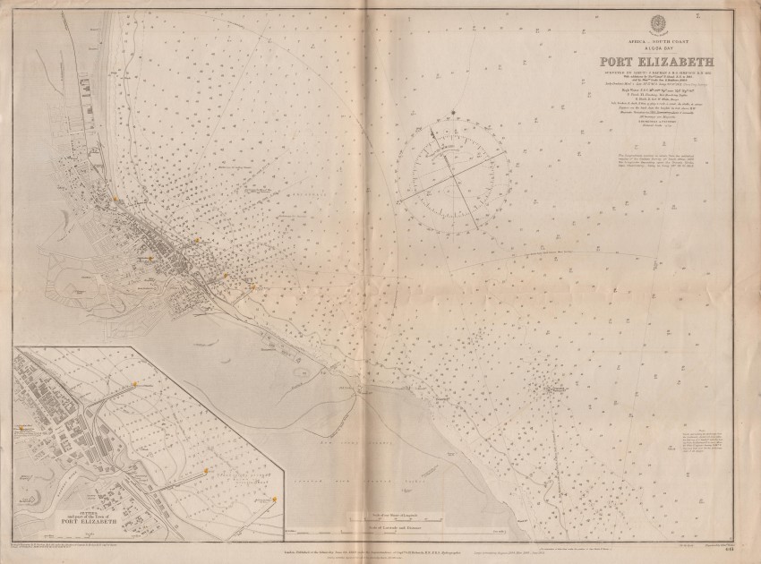
A folded British Admiralty chart of Port Elizabeth with an inset of the jetties and parts of the town of Port Elizabeth. The detailed survey was conducted in 1855 and updated 1885 & 1898 - this edition of the chart was published in 1905 after updates. Some dirt along the fold line.
- Overall Condition: Very good
- Size: 64.5 x 48 cm
- Sold By: Roger Stewart Antiquarian
- Contact Person: Dr. Roger Stewart
- Country: South Africa
- Email: [email protected]
- Telephone: +27836541081
- Preferred Payment Methods: LOCAL: EFT; INTERNATIONAL: Bank Transfer; Visa and Mastercard via PayFast
- Trade Associations: IMCOS

Similar lots in the current auction View all
Click on an item to view more details and to bid.


