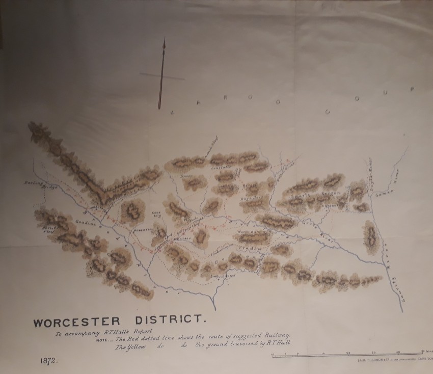
This map accompanied an 1872 report to the Cape Government on a possible route for the railway line in the Worcester district - from Worcester to Touws River. It also shows the routes Hall followed in order to come to his proposal.
In 1872 Cape Government Railways was formed in order to make progress with the railway line that had not progressed beyond Wellington for a decade. Overcoming the Cape Fold Mountains was a major challenge. Worcester was reached in 1876 and Beaufort West in 1880, but by a different route from the one proposed by Hall
The top left corner of the map (blank) was missing and has been replaced; small marginal tears have been professionally repaired. The map is a chromolithograph printed by Saul Solomon & Co., steam lithographers in Cape Town..
A fascinating map of Cape railway history
- Overall Condition: Good - restored
- Size: 59 x 44.5cm
- Sold By: Roger Stewart Antiquarian
- Contact Person: Dr. Roger Stewart
- Country: South Africa
- Email: [email protected]
- Telephone: +27836541081
- Preferred Payment Methods: LOCAL: EFT; INTERNATIONAL: Bank Transfer; Visa and Mastercard via PayFast
- Trade Associations: IMCOS

Similar lots in the current auction View all
Click on an item to view more details and to bid.