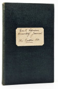
First edition: 498 pages, coloured folding map as frontispiece, 2 other folding maps, 5 sketch maps and plans, light foxing on the page edges. This copy now bound in half leather and marbled boards, with the title to the spine, five raised bands to the spine. Two ex-library inks stamps, one at the rear of the title page. And one on the last page. It seems that the third fold-out map is a very good copy on very good paper - such that it looks like the original.
THE MAPS INCLUDE: Map of Mr. Churchill's route (To face title page) small tear top right corner, The Theatre of the Operations in Natal, Map of the Operations of the Natal Field Army from January 11 to February 9, which includes: The Capture of Potgieters ferry, The passage of the Tugela, The affair at Acton Homes, The action at Venter's Spruit, The battle of Spion Kop The battle of Vaal Krantz. MAP OF THE OPERATIONS FROM FEBRUARY 14 TO 28, INCLUDING: The Reconnaissance and capture of Hussar Hill, The capture of Cincolo, The engagement of Monte Christo, Occupation of the Hlangwani Plateau & The Battle of Pieters. All the maps still in very good condition. With the following plans: The States Model schools / Potgieter's ferry / Position at Monte Cristo / The Colenso position.
(Mendelssohn - South African Bibliography vol. 1 page 338): The correspondence of which this volume is composed appeared in the columns of the Morning Post, and extends from October 26, 1899, to March 10, 1900. The author travelled by the same ship as Sir Redvers Buller, and arrived at Cape Town, en route for the front, on November 1, 1899, and at Durban on November 4th.
- Binding Condition: Very good
- Overall Condition: Very good
- Size: 8vo (200 x130mm)


