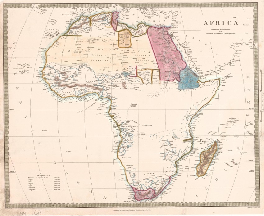
This 1839 map was highly regarded when published, but it also may be viewed as a cartographic paradox: it was produced under the supervision of the well-intentioned SDUK (Society for the Diffusion of Useful Knowledge); yet it reflects the lack of knowledge in Europe of vast tracks of the interior that within a few decades would be carved up by European countries in the 'Scramble for Africa". Nevertheless, the SDUK produced maps that honestly reflected what was known in Europe at that time - and this map of an Africa is an excellent example.
The course and source of the White Nile was still speculative. Lake Maravi or Zewa appears in a from that reflects the indirect knowledge in Europe (related by early Portuguese travellers) of this Rift Valley lake, which would be explored by David Livingstone two decades later.
This map was engraved on steel for the SDUK by the highly regarded John Walker of J. & C. Walker. The society had a copyright dated in 1839, but the map was issued in Volume two of Chapman and Hall's 1844 edition of Maps of the Society for the Diffusion of Useful Knowledge.
Later and-colouring has enhanced the map. A tear on the right into the Indian Ocean at about 10°S has been expertly repaired and is now hardly noticeable to the naked eye. Overall, the map is in very good condition.
Reference: Tooley's Guide to Collectors ... p.111. Not in Norwich
- Overall Condition: Very Good (restored)
- Size: 40.5cm x 3.2cm
- Sold By: Roger Stewart Antiquarian
- Contact Person: Dr. Roger Stewart
- Country: South Africa
- Email: [email protected]
- Telephone: +27836541081
- Preferred Payment Methods: LOCAL: EFT; INTERNATIONAL: Bank Transfer; Visa and Mastercard via PayFast
- Trade Associations: IMCOS


