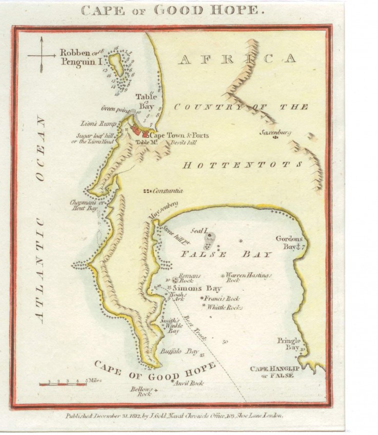
This small map is from Joyce Gold's Naval Chronicle. The map is derived from d'Apres de Mannevillette's 1775 Plan du Cap de Bonne Esperance (1775) which, in turn, was derived from the 1752 triangulation survey of Nicolas-Louis de Lacaille.
The 'best track'across False Bay to Simon's Bay, used by the Royal Navy at that time, is shown. Cape Hangklip, as it is known today, is shown with its original spelling: 'Hanglip' (without the k).
The two wines estates, Constantia and Saxenburg, are shown because they were visited by Lacaille and were included on his small map. Today's Muizenberg is Muysenberg on the map(Muys Zijn Bergh - Mouse, his mountain): this reflects the name of Sgt. Muys , who was one of the early postholders to live at the Post House ('Het Posthuys', 1673), which was saved from demolition and now a museum.
- Overall Condition: Fine
- Size: 11.5cm x 14.1cm
- Sold By: Roger Stewart Antiquarian
- Contact Person: Dr. Roger Stewart
- Country: South Africa
- Email: [email protected]
- Telephone: +27836541081
- Preferred Payment Methods: LOCAL: EFT; INTERNATIONAL: Bank Transfer; Visa and Mastercard via PayFast
- Trade Associations: IMCOS


